Residents in west Harris County have traditionally relied on groundwater pumped from individual wells by municipal utility districts or other water suppliers. Not many people realized that there was a growing problem with land subsidence in their area, or that aquifers supplying the region were beginning to decline. Few noticed when — in the early 1970’s — just 50 miles south an entire subdivision was overwhelmed by flooding and sank into the marsh.
The Harris-Galveston Subsidence District — created by the Texas Legislature to “end subsidence” — was armed with the power to restrict groundwater withdrawals. The District issued its first groundwater regulatory plan in 1976, prompting industries on the Houston Ship Channel to convert to surface water supplied from the recently completed Lake Livingston reservoir. As a result, subsidence in the Baytown-Pasadena area was dramatically improved, and has since been largely halted.

Illustration of subsidence in a Gulf Coast aquifer as a result of groundwater withdrawals producing a decrease in the potentiometric surface (the groundwater level). Source: Kasmarek, M.C., Ramage, J.K., and Johnson, M.R., 2016, Water-level altitudes 2016 and water-level changes in the Chicot, Evangeline, and Jasper aquifers and compaction 1973–2015 in the Chicot and Evangeline aquifers, Houston-Galveston region, Texas: U.S. Geological Survey Scientific Investigations Map 3365, pamphlet, 16 sheets, scale 1:100,000, http://dx.doi.org/10.3133/sim3365.
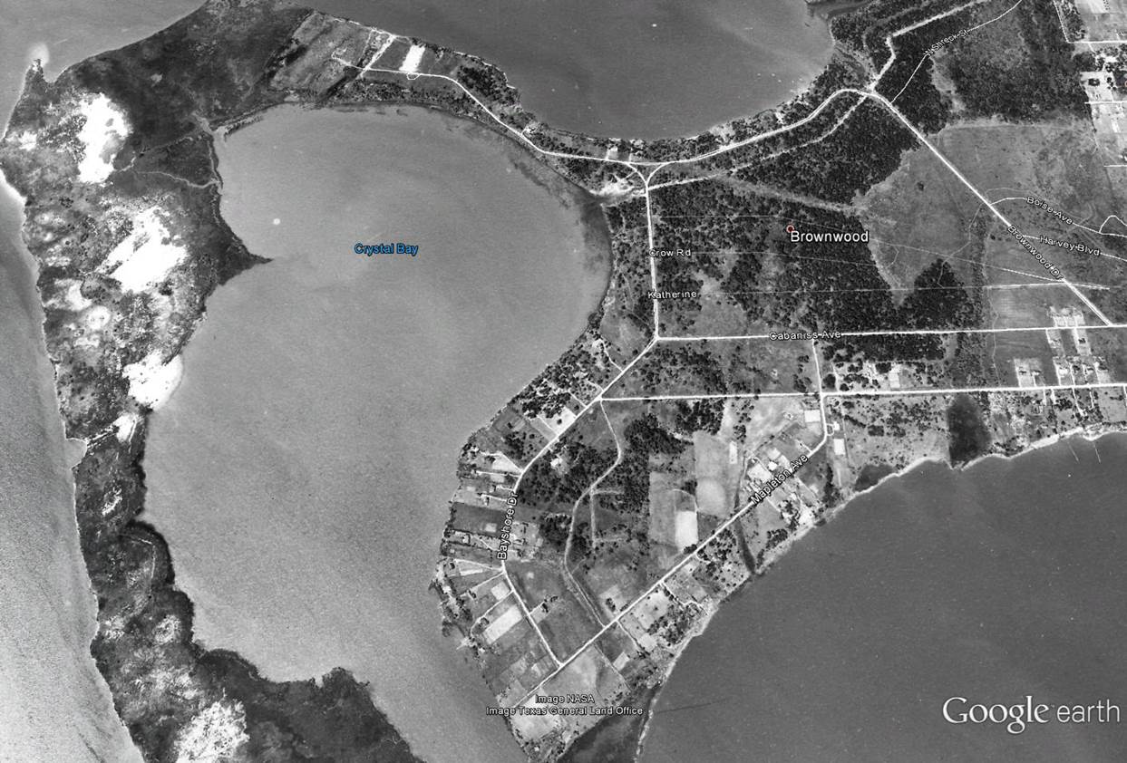
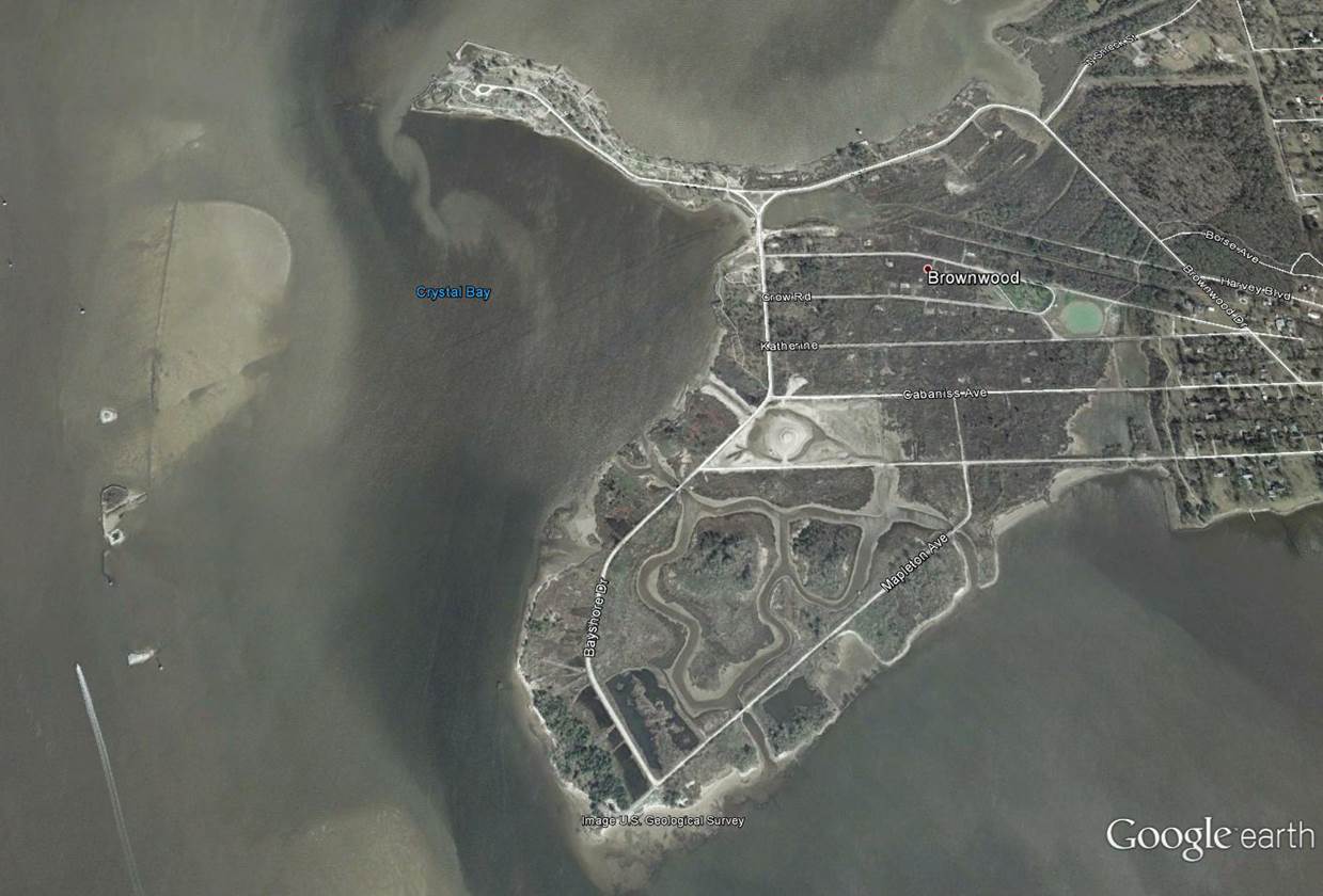
Subsidence comparison of Brownwood Subdivision
Use the divider in the middle of the photos to the right to compare Brownwood from 1944 to 2002